As we are discussing visualizing information and tools, I didn’t want to write a long blog post with words. So I decided to share some interesting maps I found and a couple of good project that are going on right now and deal with geospatial tools and mapping. Please check them out.
The Spatial History Project from Stanford University. Their projects “operate outside of normal historical practice in five ways: they are collaborative, use visualization, depend on the use of computers, are open-ended, and have a conceptual focus on space”. They use visualization not as a tool but as a research method. http://www.stanford.edu/group/spatialhistory/cgi-bin/site/index.php
Visualizing Emancipation from the University of Richmond and the Office of Digital Humanities at the National Endowment for the Humanities http://dsl.richmond.edu/emancipation/
Maps from:
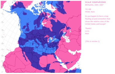
Bill Rankin’s Radical Cartography

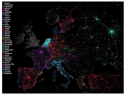
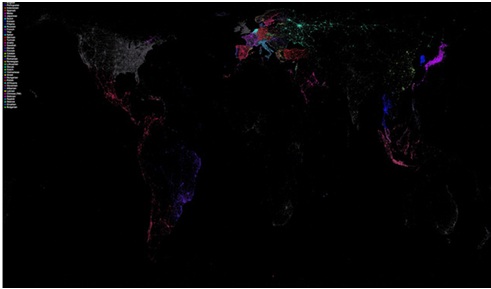
Language communities of Twitter